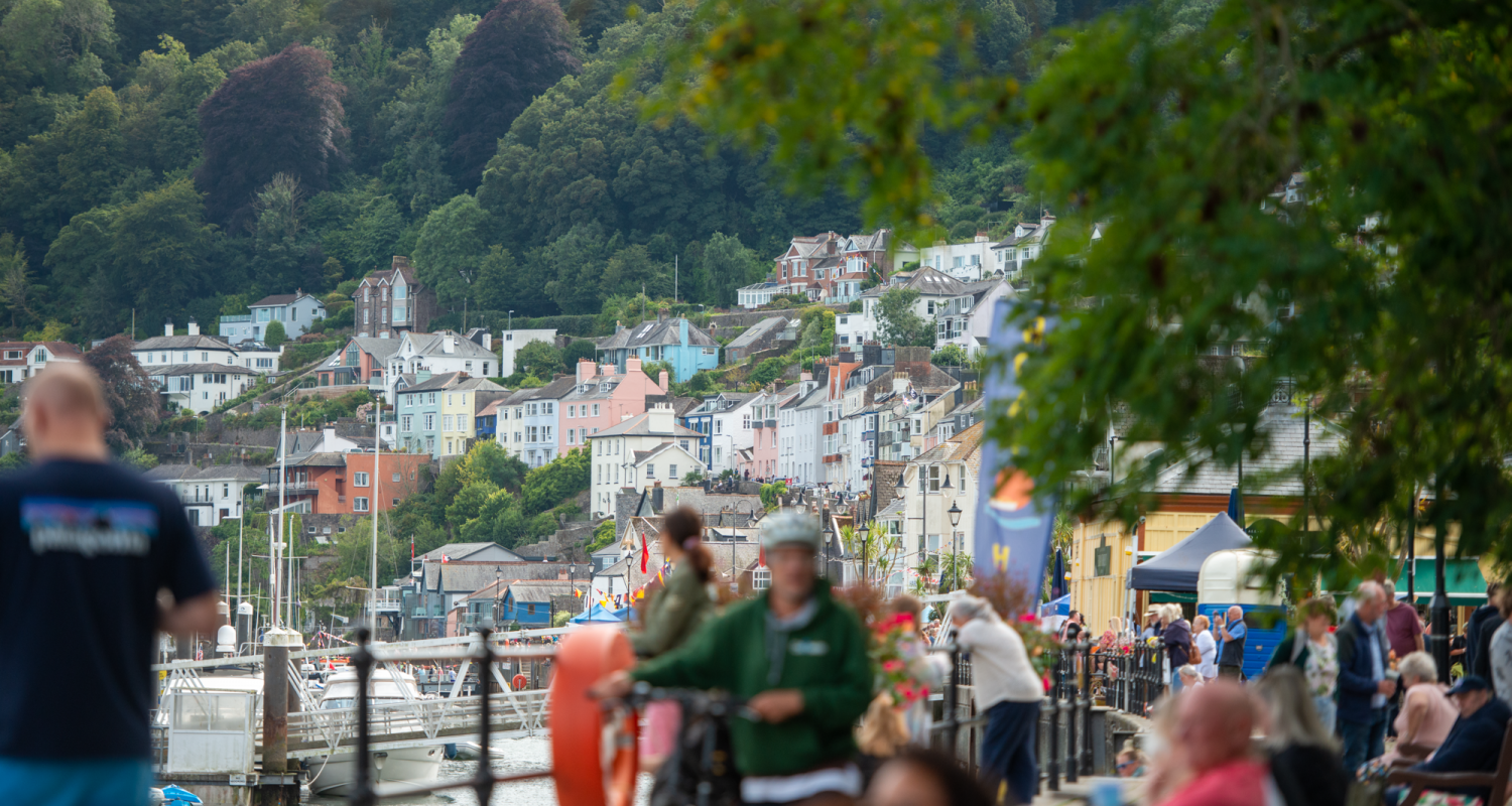
Enjoy the anticipation of your holiday in Dartmouth by delving into the planning and organising of it all.
Dartmouth town is full of hidden streets and cobbled lanes – so a Map of Dartmouth is certainly a good thing to have. Nearly everything is in walking distance, so you can enjoy exploring Dartmouth at your own leisurely pace.
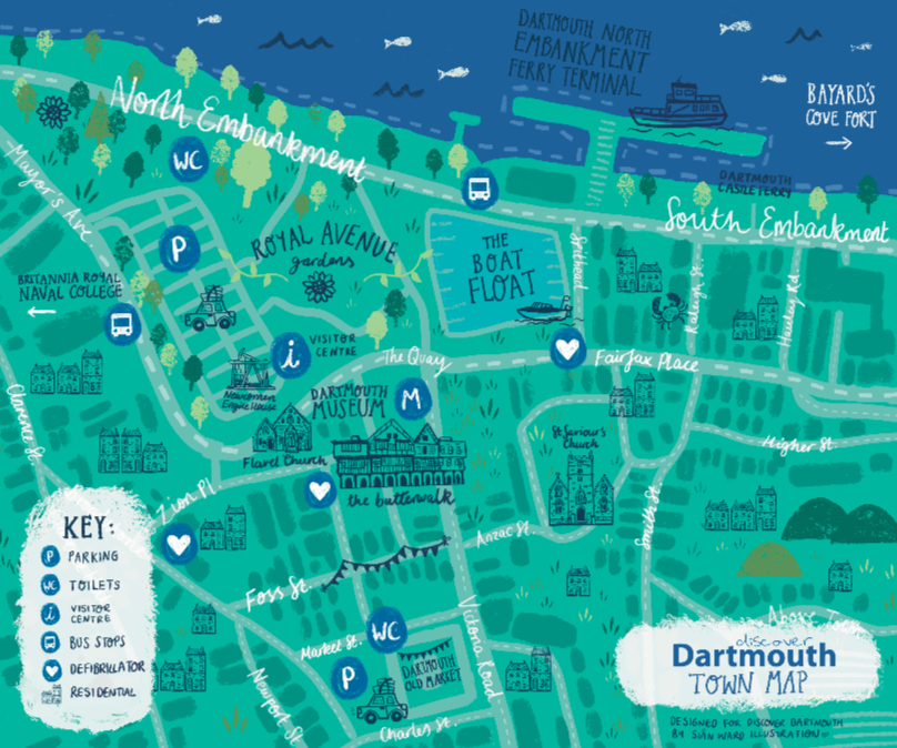
Dartmouth is a town made for wandering, and having a clear map makes it much easier to find your way. We’re thrilled to offer two beautifully illustrated maps download, designed in-house by our Marketing & Content Assistant, Siân, to give visitors a straightforward guide to both the town centre and the surrounding area, showing the local attractions, amenities and travel connections. You can find more of Siân’s artwork at Siân Ward Illustration.
Dartmouth Town Map
The Town Map focuses on the central part of Dartmouth, where most of the shops, cafés, galleries and historic sites are found. It shows how the Embankment leads into the town, with routes branching off towards Foss Street, the Boat Float and the Market Square. Landmarks such as Bayard’s Cove Fort, the Butterwalk and Dartmouth Museum are included, as well as practical facilities like car parks, toilets, defibrillator points and the Visitor Centre. The map provides a clear picture of the town’s layout, making it easier to move between the waterfront, the historic centre and quieter backstreets.
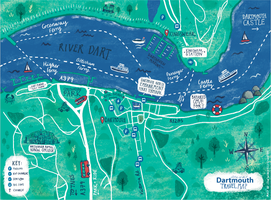
Dartmouth Travel Map
The Travel Map offers a wider perspective, showing how Dartmouth links to its surroundings. It shows ferry crossings over the River Dart to Kingswear, including connections with the Dartmouth Steam Railway, as well as the road routes into town. The location of Dartmouth Castle, the Park & Ride and Coronation Park are also marked, along with the Britannia Royal Naval College overlooking the harbour. For visitors arriving by car, boat, or public transport, the map is a useful reference when planning how to get around.
These maps are designed to make getting around Dartmouth a breeze, whether you’re visiting for a few hours or a few days. The Town Map shows the streets, landmarks, and facilities you’ll need, while the Travel Map helps you understand how the town links with its surroundings, including ferry crossings and key attractions. Together, they give a complete picture of the area, making it easier to plan your route, decide what to see, and move between different parts of the town and nearby locations. Even if you like to explore without a strict plan, having the maps on hand means you can quickly find your way back to the town centre, the waterfront, or transport connections when needed.
for high res versions of the maps, please click on them which will open a pdf. You can then use this to zoom in or download them to your device.